Cycling from Bellingham to Elsdon (cycling into Redesdale on route 68)
Bellingham

As ‘outsiders’ at this time with the covid restrictions just lifting we weren’t sure where we were welcome to sit (some pub benches still had ‘do not sit here’ signs) but we had to stock up on energy before leaving Bellingham. The first climb out of Bellingham is shared not only with the Pennine Way but also with motor traffic on a fairly steep and curvy road that is busy by virtue of being an important link route. When you lose the houses and pavements either side and pass the caravan park, this becomes a section of the cycle route to just plug on with and not relax or drift about. The good news is there is no navigation to do.

Spoil heaps from the old mining days mark the peak of the
hill and give a pleasing platform for grazing sheep.
After this short slog up the hill (80 metres gain) you’re on
fairly narrow roads with a massively abundant hedge on one side (especially
full of pink wild roses) while the first soft views of the watershed to
Redesdale appear on your right hand side.


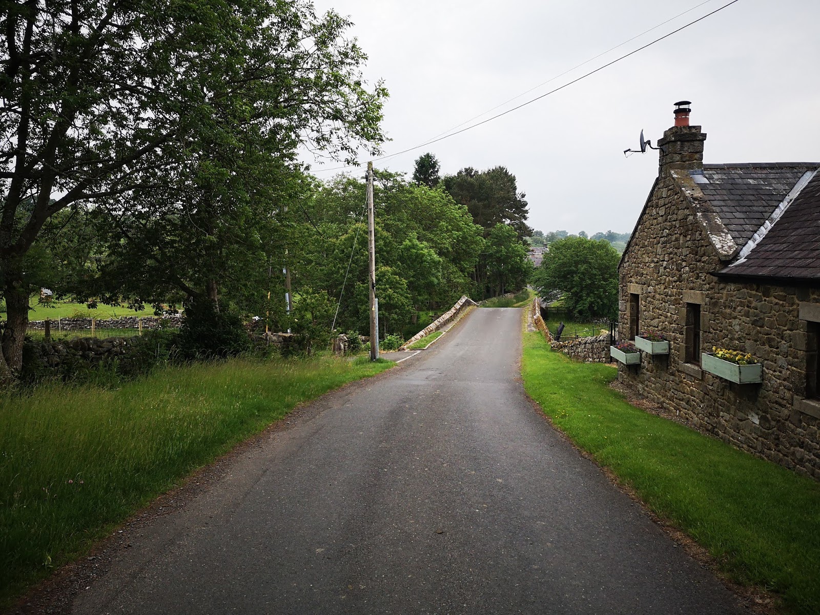
I took advantage of the laybys to take stock of where we were passing. Like everywhere in Tynedale and Redesdale, there is great detail and history in the rural buildings of the area: I’d never before noticed this bastle as part of Hole farm (looking back to where the Rede joins the Upper Tyne).


The road is pretty smooth, suitable for touring bikes as well as our own hybrids. An easy decline takes you down to your first proper stop in Redesdale.

Low Cleughs Bastle, a picturesque ruin with information board, would be a nice short walk (amongst many here), but we didn’t do any extra side trips on this occasion : one thing about cycling is it really puts your legs off walking!

Carrying on to West Woodburn stays easy and slightly
downhill, plus it has a better views around you so you feel less of a sense of
traffic risk as you gaze around. The exposed rock at Calfclose Crag looks
especially good from here.
And then the approach to West Woodburn is surprising, at
least for people like me who are used to the A68 route, who have never seen the
scenic village row from this direction before.
Ah, if only the Bay Horse had been open and there were no
troubles in the world.

We stopped for a breather, and I’d encourage anyone to get off their bikes here and push right, for the 150 metre section that you’re on the A68. Nice wide pavement and you get to see the Rede as it passes under West Woodburn Bridge.


And then this is the sign left for the road to East Woodburn.

A new bit of Redesdale for me, and it was a really lush quiet road. We passed a walker and a man teaching his daughter to ride a bike. It strikes me as a great, fairly flat, nicely picturesque stretch for anyone who wants to have a little pootle about (very little – the road connecting the Woodburns is only one and a half kilometres long and by car you’d zip between without barely noticing): in June it’s packed full of flowers and a peaceful riverside feeling.

Into the lovely collection of old buildings that is East Woodburn, where the 68 route turns left and crosses the next bridge and then heads uphill.


This uphill, coming at the end of a long day’s cycling for us, meant there was nothing for it but to push the bikes up.

The view back down behind us made us think it would be amazing fun coming the other way here on the 68 route.

Just imagine freewheeling down this way into East Woodburn and then along to the Bay Horse.

You skirt the bottom of Darney quarry (visible below) and then for a good long while you’re in peaceful, very rural country on single lane roads.

The sort of country that would be recommended as therapy for those stressed out.

Streams, hidden views, cattle grids. At one point there is
even a white gate to open and close to carry on, so you have full permission to
go as slow as you like.
One thing to mention is that the signs for the 68 cycle
route fizzled out some time after East Woodburn. Not that there are a whole lot
of choices to go wrong with, but as you go for 5 km on this lovely pastoral
valleyside you get so you’re not quite sure where your delightful, slightly
up-and-down route is taking you, the odd bit of reassurance might come in
handy!

And then it’s the A696 at Monkridge. It’s been a lovely
stretch coming down here and I am frankly terrified of this road major road. We
hadn’t researched in advance so were anticipating having the share with traffic
as we headed right and south east a little till the Elsdon turn off at Raylees.
Happily, there are people out there much forward-thinking than me and after a
layby (pictured above) which is there as you meet the A696 (meaning you do not need to venture
on to the A696 at all), there is a continuous cycle path parallel to the main
road.

Unclear signage for bikes I thought, and Caroline was about to carry on before I called to her to stop here. You cross at the roadsign for Elsdon and beware.

It is natural, if you’re not thinking, to cross over into the wrong lane, where the traffic coming out of Elsdon has a blind passage just before it joins the A696. So a bumbling cyclist could easily find themselves encountering a blindsided vehicle. Incidentally, the cycle signs here are written for the Sandstone way, temporarily equivalent to the 68.

Then after this pinchpoint, it’s back to that Redesdale country tranquility again. A little bit of uphill, tree covered lane, which is fairly narrow if there IS traffic though we met none.

Then a properly delightful freewheel into the lush green of Elsdon where we stopped again on the Rede.


We cooked up some coffee on a camping stove under the great oak, where friends came to find us, but you will no doubt make use of refreshments from the cosy Bird in Bush or Cyclists' Café.


Comments
Post a Comment